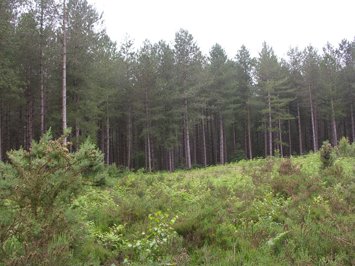
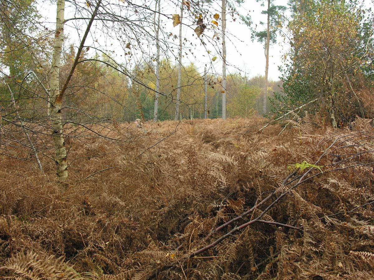
Bacton Wood
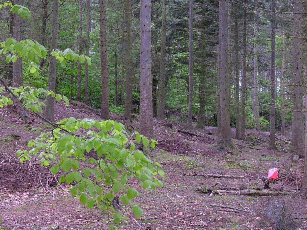
Bacton is a Forestry Commission and North Norfolk DC managed wood. It has good contour detail and has seen a full range of courses at District standard, but with several parts clear-felled or thinned, the forest is getting overun with bramble. However, with careful planning a small scale event could be accommodated.
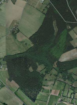
Mapped Area
Parking
NR28 9UE
TG318312
52.828757, 1.439554
Beccles Common
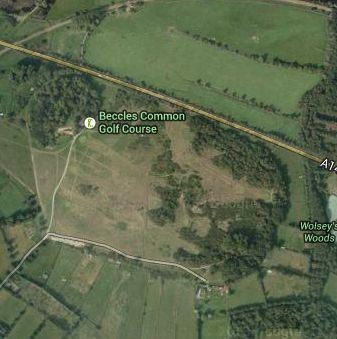
Recently used for a night event. The common surrounds a golf course.
Mapped Area
Parking
NR34 9RH
TM430905
52.458948, 1.576360
Beeston Regis
Owned by the National Trust, Beeston Regis is situated towards the eastern end of the Cromer Ridge. The area comprises woodland and open spaces with interesting contour detail to the north. Deep re-entrants make the area physically demanding. The southern part (privately leased) is mainly woodland with shallower contours and a path network
Mapped Area
Parking
NR27 9NE
TG183414
52.924745, 1.250191
Blickling
Northern and southern areas of coniferous and deciduous forest, separated by fields, are connected on the western side by a narrow band of woodland. The fields can be crossed in several places, thus improving the usefulness of the whole area. Although rather brambly, Blickling is a good venue for smaller score and informal events, yet can host a District event. The area is part of a National Trust estate which surrounds the historical Blickling Hall.
Mapped Area
Parking
NR11 6NF
TG175285
52.810395, 1.227220
Bylaugh Wood
The heath is a small area with contour detail at the west end falling away to a stream and road to the south and a marsh to the east. South of the road, Bylaugh Wood is privately owned and FC managed. There is a larger area of mixed woodland to the west and east, separated by a band of thicker vegetation.
Mapped Area
Parking
NR20 4SG
TG038199
52.738810, 1.017820
Catton Park
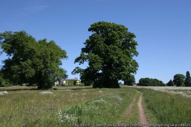
Catton Park has a permanent orienteering course and also hosts a Park Run on a Saturday morning. The club use it for small events, usually in the summer.
Mapped Area
Parking
NR6 7DR
TG233121
52.6614502, 1.2825824
Cawston & Marsham Heaths
Managed by Norfolk Wildlife, small areas of woodland are separated by open and rough open spaces, some of which are gorse-covered. Characterised by many small pits, depressions and knolls, in recent years the area has been used for score and informal events and, in 2007, a District event with courses from White to Brown. NOR are in negotiation with new owners of adjoining woodland that has been used previously to add to the current map.
Mapped Area
Parking
NR10 5QJ
TG166231
52.762597, 1.209855
Cockley Cley
The mapped area comprises Deadman’s Plantation, Cockley Cley Wood and Cockley Cley Heath. It is a large area of mainly coniferous woodland at various stages of growth, with considerable felling in recent years. Cockley Cley is notable for its large number of holly bushes and small clearings which make excellent control sites. Much of the area is privately owned, but all is managed by the Forestry Commission.
Mapped Area
Parking
PE37 8AL (Cockley Cley Village)
TF783036
52.613567, 0.627013
Felbrigg
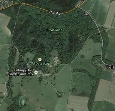
This is a popular National Trust area, with the facilities of Felbrigg Hall available to orienteers. Lying to the south of Beeston Regis, and separated from it by the A148, Felbrigg presents challenges from a series of pronounced spurs and re-entrants in its northwest part, fast running through mixed woodland to the east, and woodland and open areas to the south.
Mapped Area
Parking
NR11 8PR
TG204402
52.914466, 1.277483
Gilham’s Heath Plantation
Privately owned and split into 4 blocks by minor roads, Gilham’s Heath is mainly coniferous woodland, bracken-covered in summer. There are interesting contour features in both the eastern and western parts of the map, and, during the winter when the bracken has cleared, much of the area is very runnable. It is mainly used for score and novelty events.
Mapped Area
Parking
NR9 5TF
TG151172
52.709739, 1.182910
Hockering Wood

Hockering Wood is a small privately owned deciduous wood. It was used in the war to store munitions and evidence of the old buildings can still be seen. The area is suitable for small events and is often used for the club championships.
Mapped Area
Parking
NR20 3PZ
TG072150
52.692893, 1.065887
Hockham
Despite being mainly coniferous woodland, Hockham is an excellent orienteering area because of its large number of features, most notable of which are the pingos in its eastern part. (Pingos are marshy or water-filled depressions formed as a result of earth movement during the last ice age.) Elsewhere, much of the forest is runnable and gently undulating with a fair selection of features.
Mapped Area
Parking
IP24 1PA
TL937919
52.491081, 0.852719
Holt CP & Holt Lowes
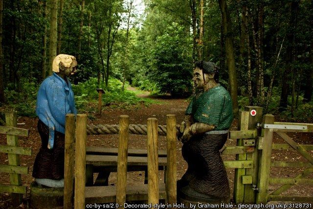
The area comprises well-contoured woodland with other earth features to the south, contoured heathland, partly gorse-covered to the east, and woodland with a comprehensive path network to the north. 2 areas of marshland run towards the southeast where they join others alongside the river Glaven.
Mapped Area
Parking
NR25 6SP
TG084366
52.887453, 1.096348
Horsford Heath
A Forestry Commission plantation featuring 2 tumuli and crossed in both directions by a series of open rides, Horsford Heath appears a simple area for orienteering but requires considerable concentration nonetheless! Features include many shallow depressions, small knolls and shallow ditches. Bracken-covered in summer, the area comes into its own in the winter.
Mapped Area
Parking
NR10 3EE
TG184175
52.711492, 1.232464
Houghen Plantation
On the opposite side of the Norwich/Holt road from Horsford Heath, Houghen Plantation offers very different orienteering from the blocks of forest on the Heath. Under several ownerships (private and common land) it comprises a mixture of deciduous and coniferous woodland with a good range of features including earthwalls, pits, depressions and ditches. A marshy area bisects Houghen Plantation, and another separates it from Drayton Drewray. Much of the area is partly bracken-covered in summer, but is mainly runnable in winter.
Mapped Area
Parking
NR10 4DX
TG170159
52.697444, 1.210574
Kelling Heath
Part of the Cromer Ridge, the area is bisected by the North Norfolk Railway, and sometimes only the southern part is used for events. Part of this is a Holiday Park around central facilities. The west (Kelling Heath) is open or rough open land, variably gorse-covered, whilst the north is steeply contoured with spurs and depressions. Woodland to the east and south of the caravan park (Bodham Wood) is mainly runnable. North of the railway line is more well-contoured heathland (Salthouse Heath) which is partly gorse-covered, with views over the North Sea.
Mapped Area
Parking
NR25 6QL
TG120400
52.928795, 1.149757
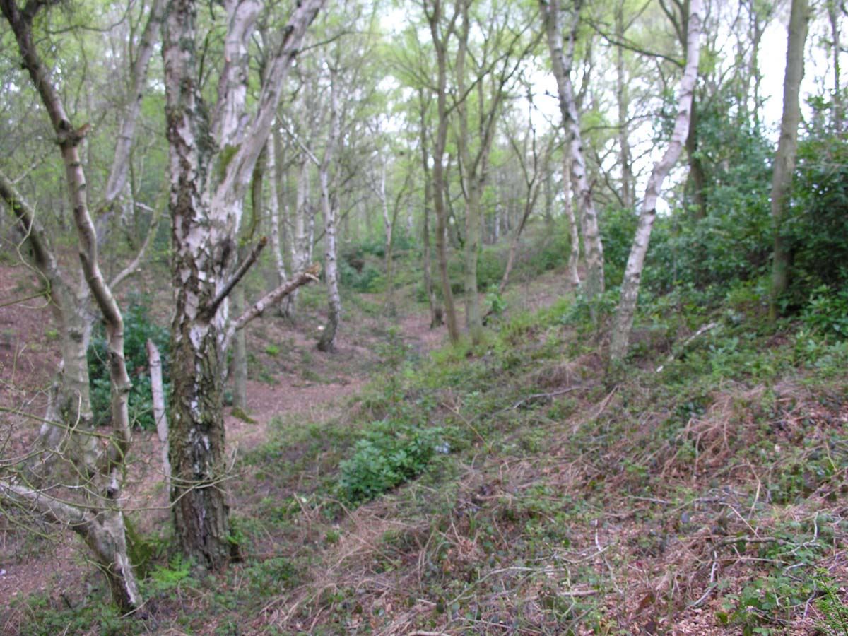
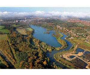
Ken Hill
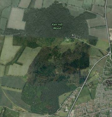
Mainly a private estate but with some common land on the southern side, Ken Hill has changed in recent years with the clearance of large areas of rhododendron. Ken Hill comprises a central area of woodland and rough open land with steep contours to the north, west and south of it, a low-lying area further to the north (illustrated in the picture) crossed by a number of deep ditches, and an area with many land form features to the south. There are many vegetation features including the remaining patches of rhododendron.
Mapped Area
Parking
PE31 7RL
TF682353
52.889412, 0.499135
Lynford

The southern part of Lynford comprises mixed ages of coniferous forest and open land with occasional large depressions, typical of much of the Thetford area. Towards the north, more woodland is separated by lakes, a stream and marshy areas. To the east of Lynford Hall is a runnable arboretum, to the west a long vista, flanked by 2 rows of giant redwoods, which has been used to good effect for the finish of a Regional event and a Compass Sport match. At the extreme north are old gravel workings and open land.
Mapped Area
Parking
IP26 5EL
TL816929
52.504345, 0.675613
Mousehold Heath
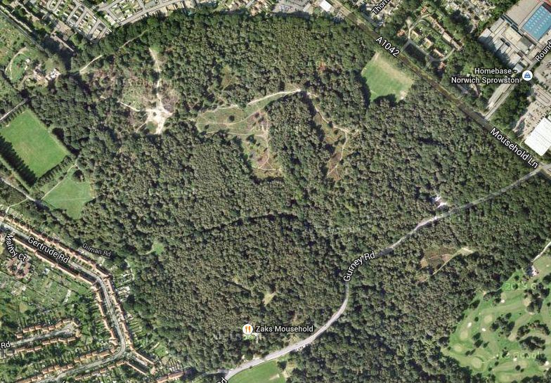
Situated to the north of the city centre, Mousehold Heath is mainly on a hillside overlooking Norwich. With complex contours and land form features, the area has puzzled many good orienteers! A network of paths crosses the mainly wooded landscape; there are open and rough open clearings, patches of denser vegetation and undergrowth.
Mapped Area
Parking
NR7 8SN
TG247105
52.646262, 1.320384
Pond Hills

A small, privately owned, closely contoured area of woodland and open land lying either side of a quiet lane. Pond Hills, near Hempstead, provides sufficient area for a limited District event with courses up to Blue standard. Lack of undergrowth allows fast running despite the quite intricate contour detail.
Mapped Area
Parking
NR25 6TP (Hempstead Village)
TG099355
52.876622, 1.118252
Pretty Corner
Situated towards the eastern end of the Cromer Ridge, Pretty Corner makes up for its relatively small size with its complex contours. Mainly wooded, but recently partly felled in the south east corner, Pretty Corner proves that not all Norfolk is flat. Several earth walls are useful handrails, as are some distinct vegetation boundaries. Paths tend to follow the re-entrants, but, especially during the winter, much direct running between controls is possible if not always wise.
Mapped Area
Parking
NR26 8PB
TG154417
52.930285, 1.203833
Roydon Common

Belonging to Norfolk Wildlife, the common is rough open heathland with intricate contour detail resulting from past quarry workings. This adjoins an environmentally valuable marshland habitat which is permanently out-of-bounds. All but small areas of the warren has recently been felled to extend the heathland and marsh habitats, revealing more details of the old quarrying. The area has been re-mapped for 2010. No orienteer should miss the chance to compete at this site, parts of which are amongst the most technical in the Region.
Mapped Area
Parking
PE32 1AS
TF680230
52.778486, 0.490143
Sandringham

From the A149 on its western side, the mid-northern part of Sandringham rises steeply to a scenic drive, beyond which to the east is an area of mainly coniferous forest. Further north, dense rhododendrons, penetrated by only a few paths, form a barrier before reaching partially scrub-covered heathland with landform and water features. More, but generally less dense rhododendrons cross the centre of the area, and to the south of these there is a mixture of heath and woodland, some of which is well endowed with pits, depressions and knolls. Sandringham is a popular area for orienteering and has hosted a number of Regional events, and the British Schools Championships twice. There is excellent car parking, close to which are restaurant and toilet facilities.
Mapped Area
Parking
PE35 6EH
TF689286
52.828863, 0.506052
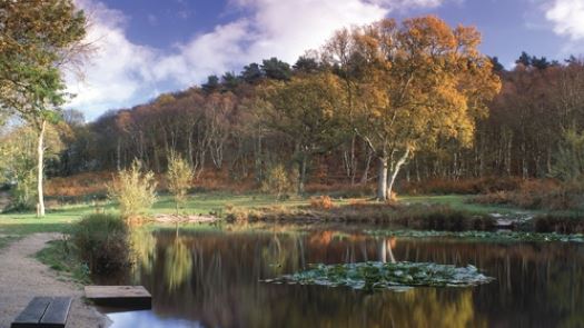
Sheringham Park
Sheringham Park, owned by the National Trust, lies to the east of Kelling Heath. Both areas, together with other surrounding land were used for the British Championships in 1992, and both have featured in other National and Regional events. Sheringham Park and Weybourne were used to stage both the 1997 and 2007 British Night Championships. Sheringham Park is a highly contoured area with many land form and vegetation features. Although mainly woodland or recently felled rough open, there is access to fields to the north which can introduce variety into the courses. Voted NOR’s best area in 2008.
Mapped Area
Parking
NR26 8TL
TG139410
52.923711, 1.181850
Shouldham Warren & The Sincks
Northern and southern parts of Shouldham Warren are separated by a deep ditch, easily crossable only in 3 places. In the northern area, the land slopes upwards from all directions towards a high central plateau. Much of the northern part is covered by coniferous woodland, though recent felling has cleared some of this to the east. Many of Shouldham’s features are associated with vegetation, there being many rhododendrons. In the southern part, the eastern sector is fast, runnable woodland whilst much of the west is overgrown with several deep ditches and marshland limiting its use for orienteering. To the far west is Mow Fen, part of which is runnable in winter, the remainder being badly overgrown.
Mapped Area
Parking
PE33 0DQ
TF679103
52.665224, 0.482123
Swaffham Heath
Separated by a small road from Cockley Cley Heath, Swaffham Heath is another typical Forestry Commission planting, but its eastern side is privately owned. From the south the land slopes upwards and then down again to a central valley, part of which is farmed. North of this the land again rises towards a major re-entrant to the northeast. The coniferous woodland is at all stages of growth, but much is becoming very runnable leading to fast times at events. Features include many individually-mapped holly bushes.
Mapped Area
Parking
PE37 8BH
TF767094
52.654276, 0.611499
Taverham Hall School
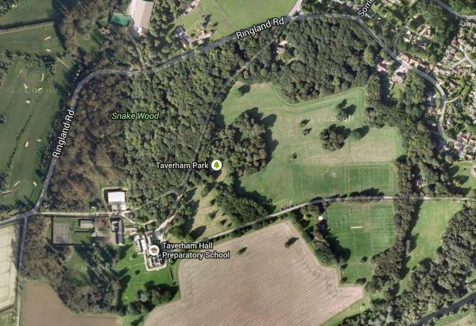
Often used as part of a series of summer events, Taverham Hall School comprises the school grounds and playing fields and to the North a deciduous wood.
Mapped Area
Parking
NR8 6HU
TG153142
52.683341, 1.184199
UEA & Earlham Park
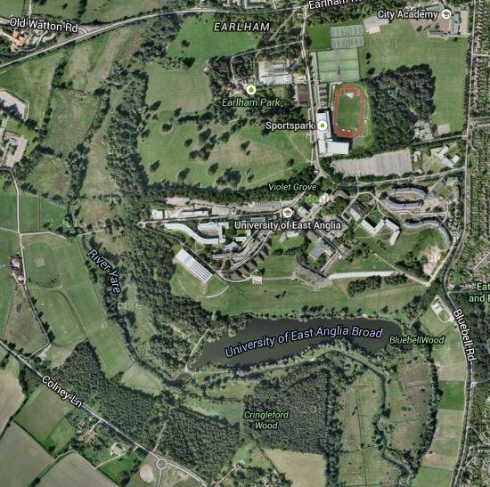
Open parkland to the north, the University campus and open land to the south are bordered to west and south by a mixture of wood, marsh and a broad, all surrounded by a river which is crossable only in several places. West of the river is more open land, south of it is woodland and marsh. Overall, the area offers fast orienteering on a far from flat site.
Mapped Area
Parking
NR4 7TJ
TG191075
52.621832, 1.236892
West Bilney

Recently re-mapped after a gap from orienteering of over 20 years, West Bilney is best suited to small events. At the southern end, the land slopes upwards from all directions to a central, flat plateau, to the north it is less undulating. Vegetation comprises coniferous woodland at all stages of growth together with recently felled rough open, much of it being runnable during the winter. Features include numerous holly bushes and occasional depressions, ditches and gullies.
Mapped Area
Parking
PE32 1JX
TF700132
52.690679, 0.513856
Whitlingham Country Park
Often used for a score event, Whitlingham Country Park comprises parkland and a small section of woodland with surprisingly steep contours. Usually controls are placed on the far side of the lake for those that fancy a longer run
Mapped Area
Parking
NR14 8TS
TG253077
52.620280, 1.327495
Wymondham College

Often used as part of a series of summer events, Wymondham College comprises extensive school grounds and playing fields separated by a small deciduous wood.
Mapped Area
Parking
NR18 9SZ
TM072984
52.544652, 1.054709